
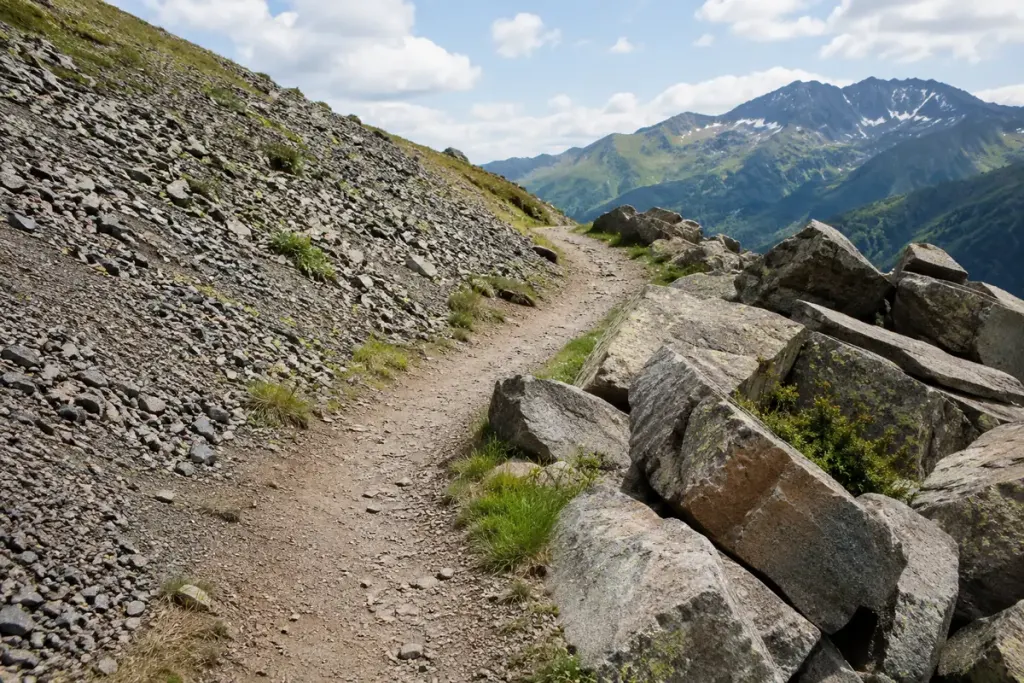
A route description mentioning scree or talus is telling you something important about the ground, not merely adding mountain vocabulary. Loose rock can change the effort, balance and consequences of a slip even when the distance looks manageable on a map.
The labels overlap
Walking guides often use scree for smaller loose stones and talus for larger angular debris. Usage varies, so a precise size boundary from one guide should not be treated as universal. Both terms can describe material accumulated below steeper rock.
The Colorado Mountain Club’s trekking instruction material treats these surfaces separately and discusses instability and rockfall. A large block is not automatically secure, and a shallow layer of small stones may slide over the surface beneath it.
Translate the description into questions
Before choosing a route, ask how long the loose section is, how steep it is, whether it is exposed and whether there is an established alternative. Check current local information, weather and closures. A photograph taken in dry summer conditions cannot establish how the same slope will behave when wet or icy.
Imagine two fictional walks, each six kilometres long. One follows a maintained valley path; the other includes a short exposed traverse across loose debris. Their distance is equal, but the terrain demands are not. A route grade and a detailed description are more informative than distance alone.
Make the decision before commitment
For unfamiliar terrain, choose a route within your experience and seek local guidance or instruction. Keep to established routes where required and avoid shortcuts that dislodge material or damage fragile ground. Consider other people above and below, not only your own footing.
If the ground is less stable than expected, reassess while a straightforward retreat remains available. There is no obligation to continue simply because the map shows a line through the slope.
Learning the terms is useful when it improves a practical decision. The important question is not whether a patch deserves one geological label or another; it is whether you understand the surface and have an appropriate plan for crossing—or avoiding—it.