
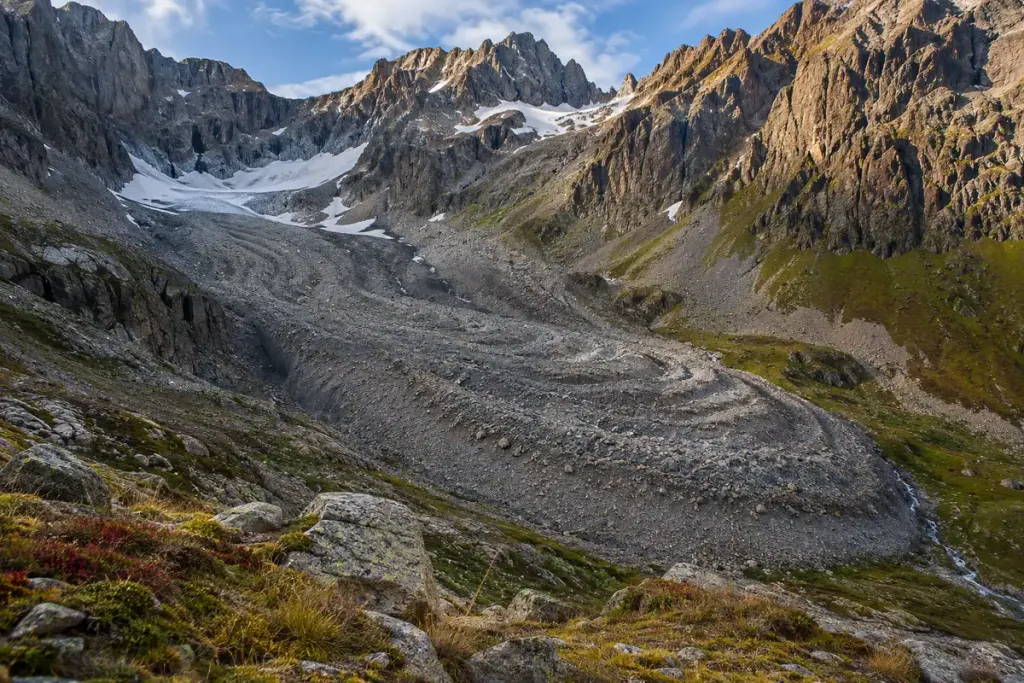
A tongue of angular stones can look like an enormous heap that stopped moving long ago. In a cold mountain landscape, it may be a rock glacier: a landform whose icy component is not necessarily visible from the trail.
The US Geological Survey’s glacier glossary describes rock glaciers as accumulations of angular blocks with little or no exposed surface ice. Ice can occupy spaces within the debris, and some rock glaciers move very slowly. A stony surface therefore does not settle what lies beneath it.
Observe the shape without claiming a measurement
From an established viewpoint, look at the overall outline, the steep front and any ridges across the surface. These can be useful features to discuss with an interpretive panel or a geological map. A single photograph cannot establish present movement speed, ice content or stability.
For a walking notebook, record the viewpoint and date before describing what you see. “A lobed mass below the cirque” is an observation. “It moved several centimetres this year” would require measurements that an ordinary visit has not supplied.
Let the local route guide the visit
Parks Canada’s Rock Glacier Trail information for Kluane gives a specific example of an interpreted route and warns about loose rock beyond the observation area and slippery conditions when wet. Those details describe that trail; they should not be treated as a safety assessment for another mountain.
Check the current route information, weather and access advice for your destination. Stay within your experience and equipment, and do not leave a sound trail just to search for buried ice. Loose blocks can make an apparently short detour difficult.
The rewarding part of recognising a rock glacier is the change in how you read the landscape. A surface that first seemed inert becomes a clue to a colder history and, in some places, continuing movement—without needing to turn your walk into an improvised field experiment.